Locals will discourage you from hiking to Lukomir because of the risk of landmines and wolves, as well as the terrible condition of Bosnia’s post-war trail network. However, it is doable with patience, experience, preparation and a good map.
Several routes from Sarajevo lead to Lukomir, but I recommend starting from the village of Hrasnica on Mt. Igman’s north slope. Here the initial trail has been partially restored and the mine risk is negligible. Hrasnica can be reached by bus from Ilidza, which sits at the farthest end of Sarajevo’s tramline.
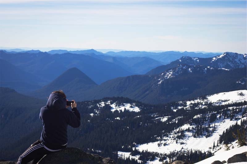
The Hrasnica footpath falls apart after the Olympic cross-country ski runs around Malo Polje, but good orientation skills will take you into a gorgeous valley near the centre of the Bjelasnica range below the peak of Hranisava. Below the mountain is Mrtvanje (also known as Stanari), a small village inhabited only in summer, which is in many ways more rough than Lukomir, lacking electricity and running water. It has a hikers’ refugee open on summer weekends. From here, path finding is much easier and Lukomir lies a day’s march roughly south over an incredible stretch of otherworldly highlands.
Up to three and half percent of Bosnia’s land is contaminated by minefields, one of the highest percentages in the world. Mines are only a risk in the Bjelasnica area around the mountain’s eastern slope; walking to Lukomir by my route should keep you clear of danger. Nonetheless, you should contact Sarajevo’s Mine Action Centre (tel: 387 33 667 310; www.bhmac.org) for updates and to consult their maps of known minefields. They usually discourage hiking without a local guide.
The most up-to-date hiking map I was able to find was from 1987 and based on Yugoslav army cartography. Though the relief and plotting are accurate, the trail system has long since fallen apart and you should not trust the trail routes for anything more than a general guide. It got me lost more than once; a compass and your gut instinct will serve you better. I purchased my old Alpine Federation of Bosnia and Herzegovina Bjelasnica-Igman map from the Bjelasnica Mountaineering Association (Zelenih Beretki 15; tel: 387 033 535 371) in Sarajevo’s Bascarsija, just east of the Tourist Information Centre (Zelenih Beretki 22a; tel: 387 033 220 724).
Also, consider buying the hiking guidebook Forgotten Beauty by Matias Gomez. It's the only book of its kind on Bosnia and includes maps and directions to many peaks and highlands - including sections on Bjelasnica and Lukomir. It's available at the larger BuyBook store in Bascarsija (Zelenih Beretki 8; tel: 387 033 712 010), just west of the Tourist Info Centre.
Read More:
Feature article "The Road to Lukomir—The Effects of Tourism on a Remote Bosnian Village"
Add this article to your reading list